Drones are powerful tools for wildlife research and conservation, especially in previously inaccessible nature and wildlife habitats. Unfortunately, if not flown responsibly by authorized personnel, drones can be a disturbance to wildlife, causing stress to an animal’s health and well-being.
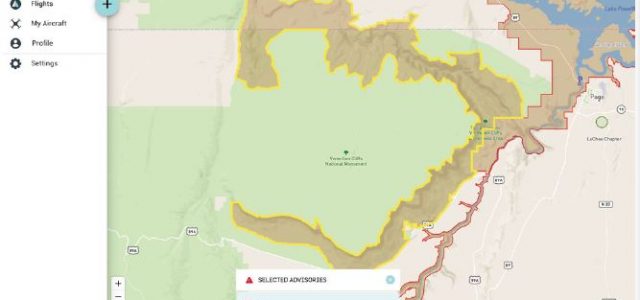
AirMap has partnered with the United States Forest Service (USFS) and Tread Lightly!, the national nonprofit for the promotion of responsible recreation, to help educate drone users about designated fly zones over public lands. As part of Tread Lightly!’s “Respected Access is Open Access—Drones” campaign, public service announcements have been produced to educate drone users about their impact on wildlife, and now drone operators can use the AirMap for Drones application for iOS, Android, and Web to find designated fly zones as well as areas where drones are restricted.
“We are excited to partner with Tread Lightly! and address the safe and regulated use of drones over public lands through the AirMap for Drones application,” said Steve Willer, AirMap’s Manager for Territory Sales, Americas. “By informing drone operators about designated fly zones, we can help minimize impacts on wilderness and public lands.” airmap.com